Wigan Council received additional funds from the Department for Transport Cycle City programme to make cycling more attractive in Wigan borough.
Phase 1 of the plans included dedicated cycle and pedestrian facilities and cycle crossings on Robin Park Road.
Phase 2 plans were to improve cycling at the Saddle Junction and around the Newtown area, including Wallgate.
These works are now complete and residents can benefit from:
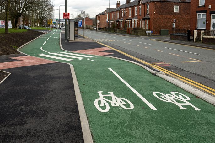
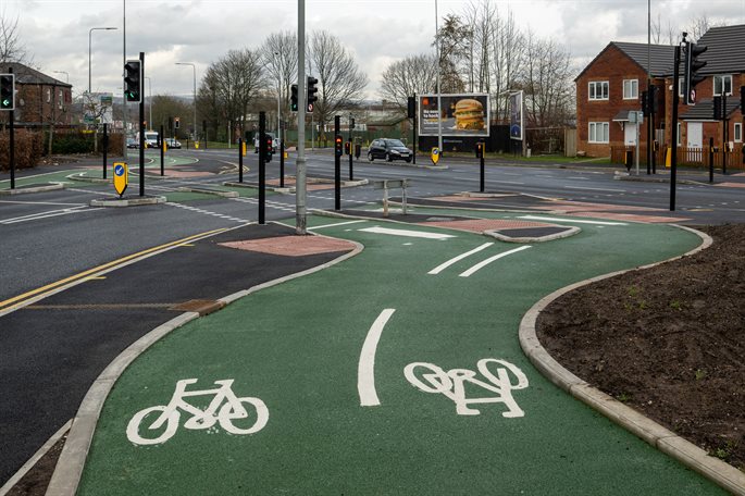
- Dedicated cycle facilities, which are segregated from traffic and pedestrians
- Wider footways to allow cyclists and pedestrians to share the space segregated from traffic
- New and improved crossing points for pedestrians and cyclists
- Improved access to Robin Park shopping and leisure complex, Wigan town centre and other local amenities
- New cycle parking facilities.
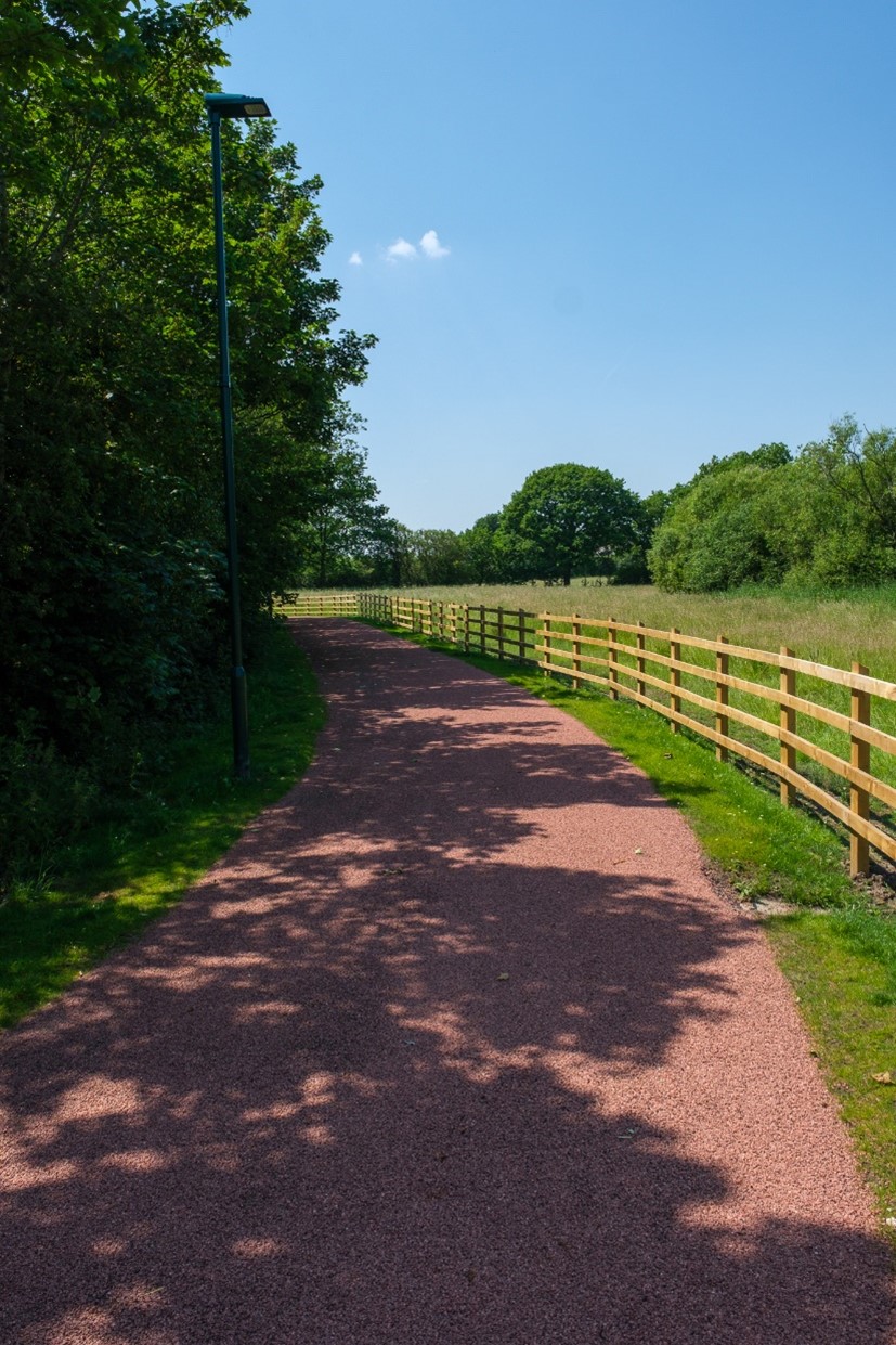
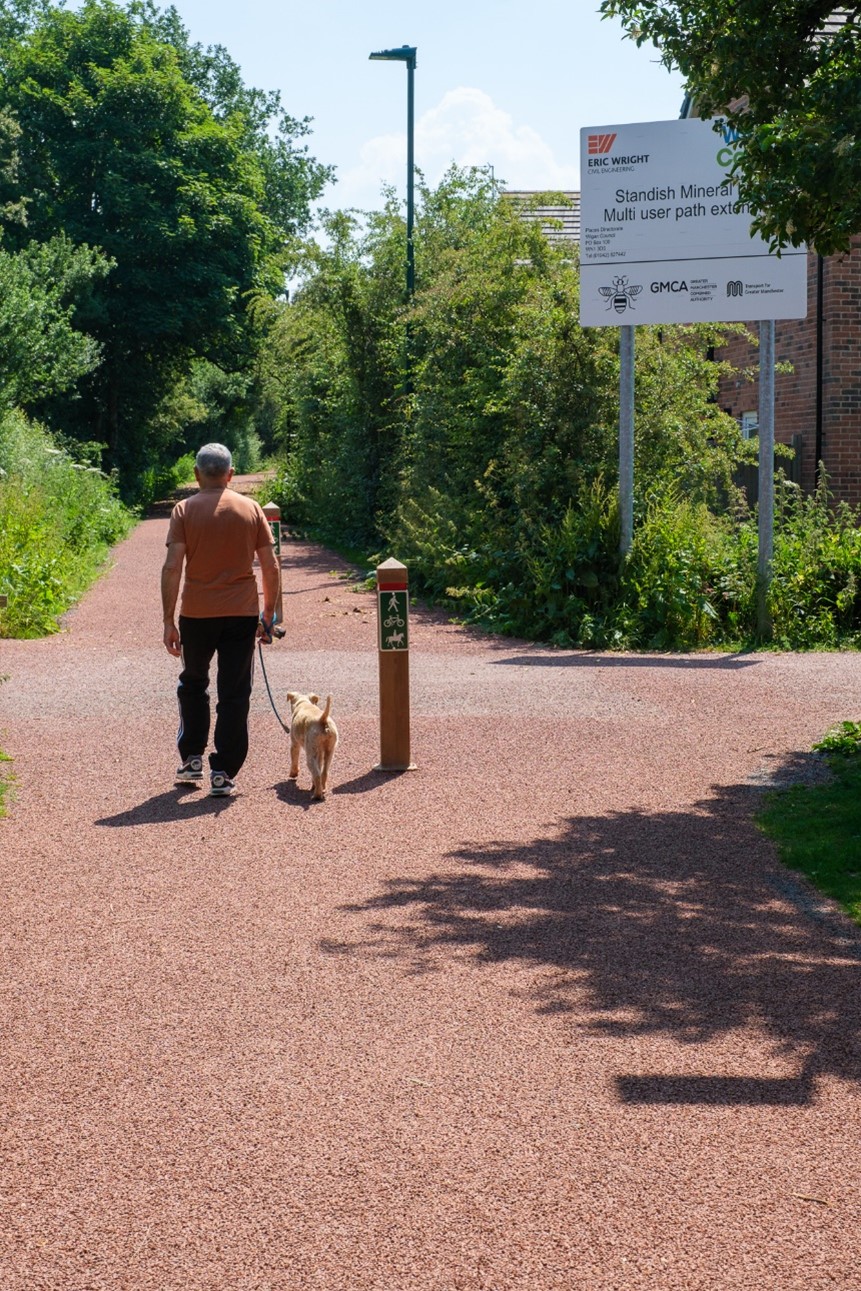
Wigan Council has upgraded the old mineral line in Standish, known locally as ‘The Line’, from a muddy track to a hard-wearing, multi-user route. With a history of coal transportation, The Line is a heritage point for Standish and a key access route into Standish centre for walkers, cyclists and horse riders.
The 3-metre-wide, illuminated, bridleway path has been funded by contributions from the new housing developments in Standish and seeks to reduce the number of car journeys and the impact that they have, especially as more houses are built alongside the route. It will also support people in leading healthier lives by providing a safe active travel option, encouraging people to walk, cycle or ride into Standish centre.
The new surfaced and lit route runs from School Lane through to Brookfield Road for a more direct and safer off-road connection between Standish centre and Shevington Moor. New connections have been created at Woodhurst Drive and Bradshaw Close, along with improvements to the car park and pathways surrounding the pond at Brookfield Road.
The Market Place area in the heart of Wigan town centre has recently been regenerated.
The upgrade included the replacement of existing benches, additional seating, recycling bins, installation of planters, trees and flowers, cycle parking facilities and lowering of the walled area.
The improvements have been developed to compliment major town centre events including the Wigan 10k, Wigan Pride and the continental markets.
The new Market Place now provides an attractive meeting point, good seating area and aims to reduce reports of anti-social behaviour. It now offers a more usable and flexible space for performances and events including markets, fairs, music concerts and more.
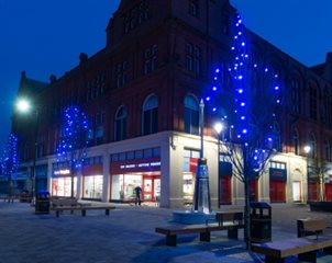
Work to transform Leigh town centre into a more pleasant area for shoppers, visitors and traders was completed in 2018.
High quality block paving, new modern seating, LED lighting and tree planters have created a much more attractive space for shoppers, visitors and businesses.
The work has been part of a £5 million investment into Leigh and further improvement works are planned.
Transport for Greater Manchester (TfGM) has now completed the redevelopment of Wigan Bus Station on Hallgate (external link).
The new bus station opened last year offering improved facilities and a more attractive gateway to the town centre.
Improvements include:
- A staffed and well-lit concourse
- Better passenger comfort and security
- Real-time bus departure displays
- Retail space, including a newsagent
- Accessible toilets, baby change and Changing Places facilities
- Improved pedestrian links to the town centre
- Covered cycle parking.
Find further information on TfGM's website (external link).
Banner
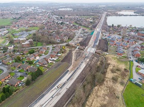
Aerial view showing the progress so far
Banner
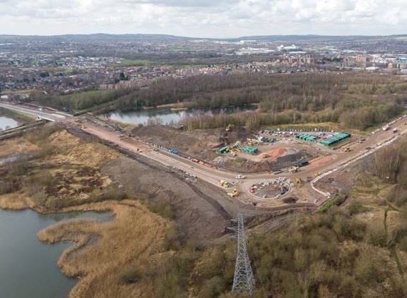
Aerial view showing the progress so far
The A49 Goose Green to Westwood Park Link Road is a connection from A49 Warrington Road at Goose Green to Westwood Park, north of Pearsons Flash and Scotmans Flash. Construction was completed and the road opened in June 2020.
The new link road comprises 2.3 km of new dual 2-lane carriageway, which includes an upgrade from single 2-lane to dual 2-lane carriageway along the existing Westwood Park internal access road. Three new major structures to bridge existing watercourses, canals and a primary road have been built, plus the widening of an existing road bridge. Other structures include two new footbridges, a new culvert and headwall and two retaining walls.
The A49 link road provide a new attractive dual carriageway gateway between the M6 and Wigan town centre, addressing congestion and air quality issues on current routes, and will also complement and support other components of Wigan’s transport strategy such as the new M58 link road.
The first Mayors Challenge Fund (MCF) scheme is now complete with improvements to the canal towpath in Astley. The works included a stretch of towpath from Higher Green Lane to the Salford border, with a new multi-user surface, as well as improved drainage, access points and signage along the canal.
This Astley section of Bridgewater Way encourages people to walk and cycle on the canal and towpath from Wigan Pier through Leigh and into Salford.
The upgrade of this ‘missing link’ has resulted in a 20-mile continuous high-quality sustainable transport route from Wigan to Salford and beyond.
The A49 and M58 link road schemes will converge at the A49 Warrington Road / Smithy Brook Road (SBR) junction in Goose Green, meaning that it will become a major intersection.
This junction improvement scheme at SBR is now complete and will improve traffic capacity on the network, as well as providing improved facilities for people travelling on foot and by bike, enhancing connectivity and maintaining road safety for all users.
The scheme has:
- Reduced the central refuge island to create additional traffic lanes in both directions on the A49 Warrington Road (between Smithy Brook Road and the A49 Link Road roundabout)
- Created an additional left turn lane on the A49 Warrington Road northbound approach into Smithy Brook Road
- Delivered two-way segregated cycle facilities to aid connectivity and maintain road safety for people on bikes
- Improved pedestrian and cycle facilities at the junction by installing toucan crossings
- Created a new walking and cycling connection to Duke Street.
This scheme has transformed the experience for people travelling by foot, by addressing the current difficulties for safe crossing posed by the ring road (Riverway). This has been achieved by providing safe and direct walking routes with crossing facilities at one of the main junctions along Riverway, Darlington Street / King Street.
The improvements will address severance, congestion, and air quality issues at this busy junction.
The Victoria Street / Warrington Road junction improvement scheme has changed the junction by removing the traffic merge so that Victoria Street and Warrington Road now have their own signal stages, i.e. when traffic on Warrington Road is moving through the junction, traffic on Victoria Street is stopped and vice versa.
There is a new crossing to help pedestrians safely cross this busy junction. This means a better flow of traffic with less queuing as well as safer movement of vehicles, making it safer for pedestrians too. The scheme has also incorporated segregated pedestrian and cycle crossing facilities, providing a continuous route from Alexandra Park along Warrington Road and connecting with the recently completed facilities at Saddle Junction cycle scheme and Robin Park Road.
There is a new toucan crossing near Alexandra Park and double yellow lines have been installed between Woodyates Street and Mere Street.
There is now a much more coherent, direct and safe cycling and pedestrian route, giving people a better experience when negotiating this busy junction.
Header
Text here
Header
Text here
Add image
Header
Text here
Add image
Header
Text here
Add image
Header
Text here
Add image
Header
Text here
Banner
Leigh to Pennington
Banner
Leigh to Pennington
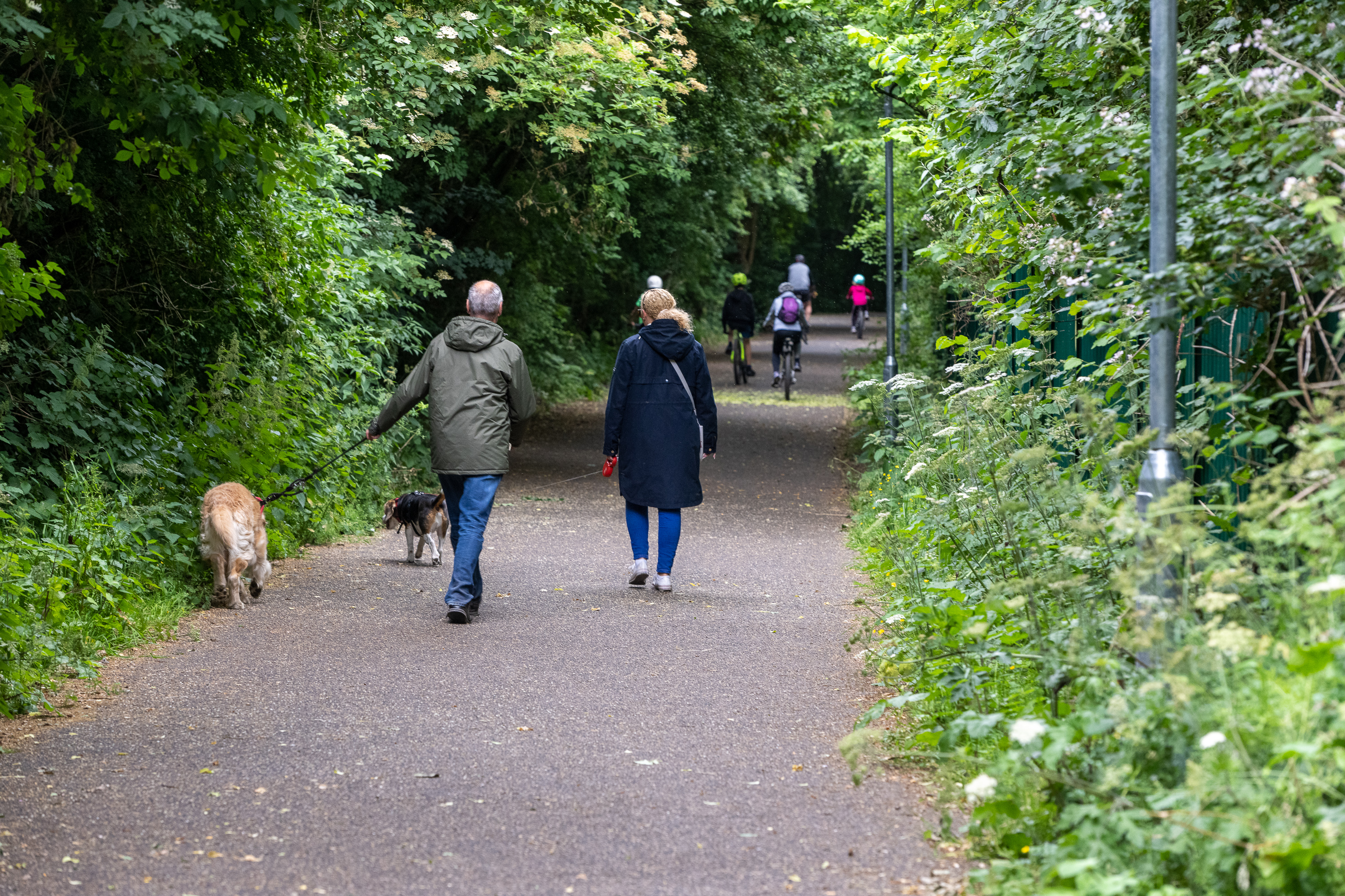
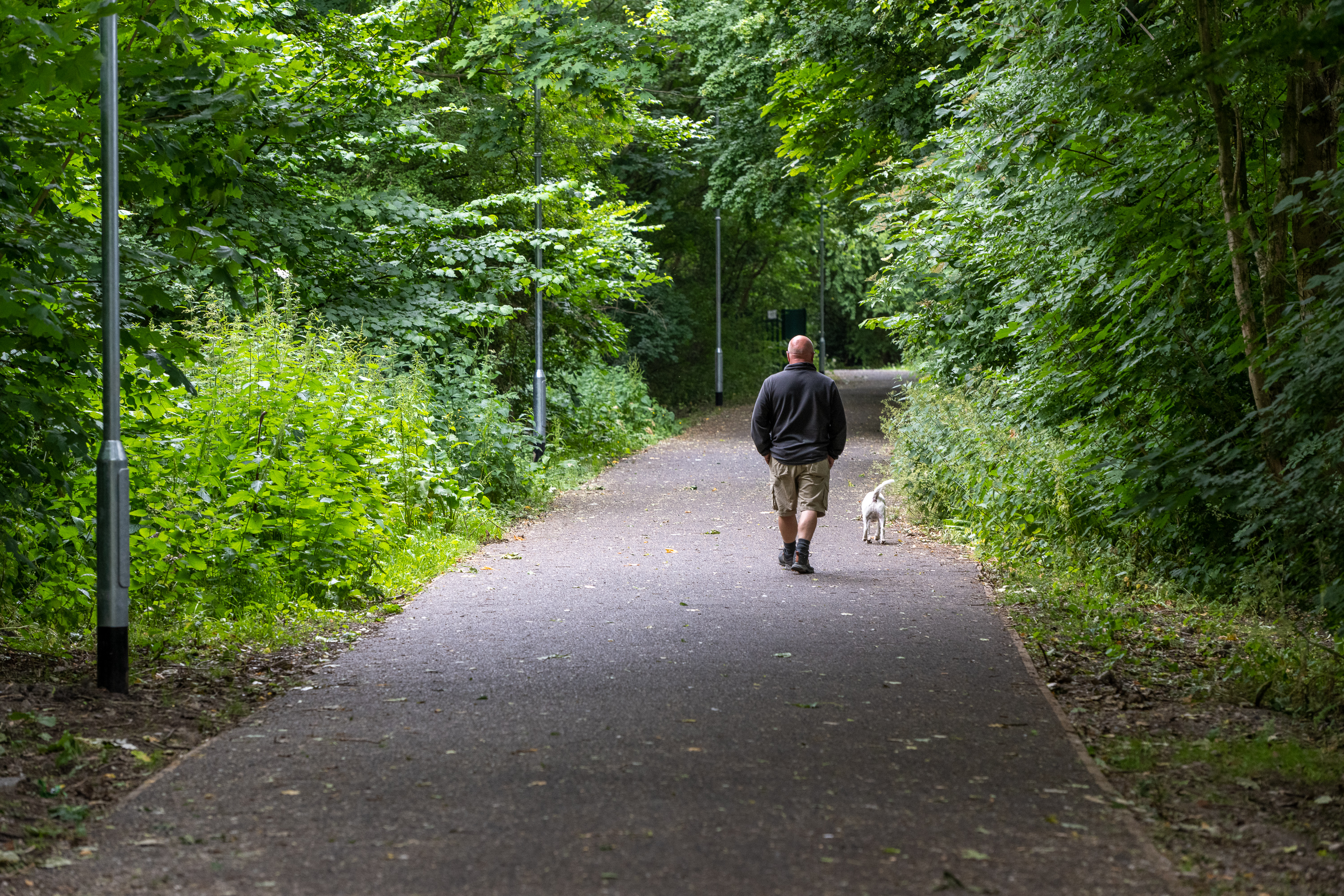
As part of our aim to create a cycling and walking network throughout Leigh, Atherton and Tyldesley, the first phase of these works has completed on site, known as the Leigh to Pennington Scheme.
The overall scheme has created a cycling and walking link between Leigh Town Centre, Leigh Sports Village (LSV) and Pennington Flash. Phase 1 has enhanced the existing off-road network between St Helens Road and the Sports Village, providing improved surfacing so the pathway can be used all year round. It is intended that lighting columns will be installed later this year.
Future Proposals
These footpath improvement works will complement a wider proposed programme of works which will look to create a continuous route from Leigh town centre, connecting to Pennington Flash via Leigh Sports Village.
St Helens Road/Bonneywell Road Crossing
The next phase of works is a new toucan crossing on St Helens Road near Bonnywell Road, which will be led by Transport for Greater Manchester (TfGM). TfGM ran a consultation on this proposed crossing back in September 2021 and detailed designs have been produced based on that feedback. Implementation on site is envisaged mid to late Summer.
St Helens Road north to south connectivity
Concepts will be developed in partnership with our design consultant and key stakeholders for north to south connectivity along St Helens Road, connecting Leigh town centre to the off-road path improvements in the coming months. We will provide a further update when the early design work commences.
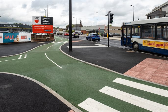
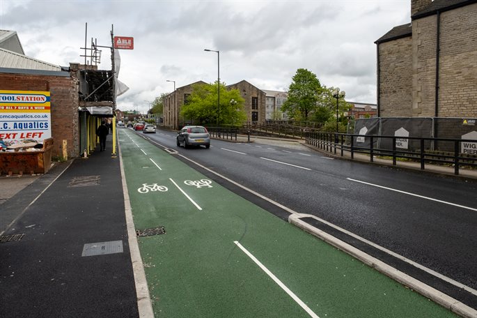
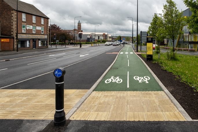
To better connect the town centre with the Wigan Pier Quarter and Robin Park area, we have transformed the environment for pedestrians and cyclists along Wallgate.
The shared footway has been upgraded into a segregated facility, so pedestrians and cyclists have their own dedicated space, from the junction of Wallgate with Great George Street all the way to Haig Street.
Two new pedestrian and cycle crossings have been installed at the following locations:
- Across Wallgate, near Haig Street, at the main entrance to the Wigan Pier Development
- Across the in and outbound carriageways of Wallgate at the junction with Miry Lane.
Other works included:
- Improvements to the junction of Wallgate with Caroline Street to include cycle facilities. A traffic lane has been removed between Queen Street and Caroline Street for vehicles travelling away from the town centre to provide space for the cycling facility.
- Improved street lighting and new trees with lights to enhance the environment, coming in November when it is tree planting season
- More benches along Wallgate to provide resting points
- Pedestrian and cycle priority across Clayton Street at the junction with Wallgate.
Header
Text here
Header
Text here
Header
Text here
Add image
Header
Text here
Add image
Header
Text here
Add image
Header
Text here
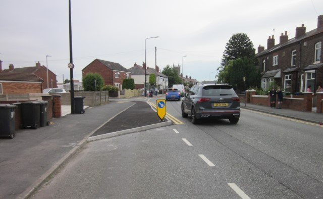
Poolstock and Poolstock Lane is used as a commuter and through route to access Wigan Town Centre and the M6 motorway and as a result is one of Wigan’s most congested corridors. This creates environmental problems on a road fronted by residential properties.
Following the completion of the A49 Link Road scheme, the new scheme aims to re-address the balance of traffic using this route and to make Poolstock and Poolstock Lane a more residential focused area.
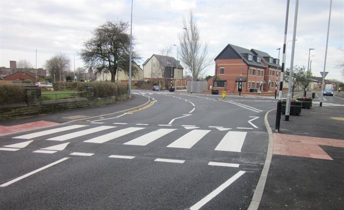
The scheme aims to transform the environment for residents and visitors to the area by assisting the movements of pedestrians and cyclists by removing heavy traffic flow and assisting the movements of pedestrians and cyclists. Amendments to junctions, road marking removal, 20mph speed limit, traffic calming features, crossing points have been used to change the characteristics of the area to provide a more residential feel.
Controlled crossing facilities at the A49 Link Road intersection and cycle/walking links to the canal at Pool Street, have enhanced walking and cycle links, providing easier access to Wigan town centre, local retail and businesses.
This scheme has now been completed.
Header
Text here
Header
Text here
Add image
Header
Text here
Add image
Header
Text here
Add image
Header
Text here
Add image
Header
Text here
Scheme plans
Scheme plans can still be accessed below.
Further landscaping proposals are being designed for the area and planting will be implemented early in 2023.
Active Neighbourhoods are simply about creating safe, attractive space for people to spend time chatting or for children to play, typically using planters or bollards on some streets to stop through access. The changes also make it easier to get around on foot, by wheelchair, with a buggy and by bike.
By purposefully removing through-traffic on some routes in the local area, we have reduced any negative impact of this on the local neighbourhood and put residents back at the centre of their communities.
All these things can have dramatic positive effects on air pollution, congestion, residents’ health and wellbeing, and safety on residential streets.
The completed works includes:
- 2 point closures / modal filters
- 3 new zebra crossings
- 3 new traffic calming chicane buildouts, with enhanced crossing facilities
- Off-road path widening and additional lighting
- Tree planting
- Improved signing and lining.
In addition to this, our activation team has engaged with the schools and residents to encourage more cycling and walking.
Activation work includes:
- Bikeability within St James’ and Worsley Mesnes Primary and the donation of bikes and helmets to both schools for use by pupils without access to a bike or safety equipment.
- Dr Bike cycle maintenance sessions delivered at St James’ and Worlsey Mesnes Primary Schools providing free bike checks and repairs for pupils and the wider community.
- Led walks in partnership with Wigan St Judes Rugby Club showcasing local walking routes.
Scheme delivery
You can still view plans for all of the work below
Monitoring
We will continue to monitor and consult with the community over the trial period to understand how effective the filters have been in helping residents get around and improving the local environment.
Standish Mineral Line Extension
Banner
Standish Mineral Line Improvements
Banner
Standish Mineral Line Improvements
Work has completed on extending the existing Standish Mineral Line to provide additional and improved sections of on and off-road facilities, creating high quality multi-user routes for walkers.
The improvements include resurfaced existing informal routes and public rights of way, providing new connections, crossing points and links to new housing developments.
The scheme provides the missing connection to the work completed by National Highways (formally Highways England) at Junction 27 of the M6 and offer safe routes for journeys into the local shopping centre in Standish, as well as to schools, health services and leisure venues.
As part of our Standish / Wigan / Ashton Bee Network, we have recently completed the Leeds and Liverpool Canal Towpath and Links scheme. The main aim of the scheme was to make our routes work for everyone and our borough a better place to live, work and visit. By creating routes that better connect our town centres and improving public space, we can help families and communities get about safely, cut down unnecessary car journeys and attract more visitors to our borough. The canal provides an opportunity for a safe and attractive commuter route to major employment areas, including Martland Park where Kraft Heinz and other businesses are located. It also runs alongside Robin Retail Park, which currently generates a lot of car journeys as a result of the shops, leisure hub and DW stadium.
The scheme was delivered in Phases starting with the following elements:
Work to this section of canal and surrounding pathways is now complete and has improved links from residential areas to employment and leisure zones. The scheme also links with the existing Robin Park Road and Saddle junction cycling and walking facilities. The overall comprised of the following:
- Upgrades to the Leeds and Liverpool Canal Towpath from Wigan town centre to Appley Bridge. including maximisation of the towpath width, removal of barriers and improved surfacing
- New pedestrian and cycle crossings on Loire Drive and Scot Lane
- Improved cycling and walking facilities around The Brick Community stadium, connecting Loire Drive to the canal
- Improved cycling and walking facilities connecting Robin Park Road with Scot Lane and Laithwaite Park
- Improved routes and path upgrades through Laithwaite Park, connecting with surrounding streets.
Scheme delivery
Work to upgrade the Leeds and Liverpool canal towpath from Scot Lane to the border with West Lancashire at Appley Bridge is now complete. Works included maximisation of the towpath width, removal of barriers and improved surfacing. The project was completed in November 2023 and you can see the improvements in the photographs.
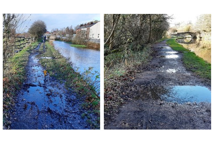 Leeds and Liverpool canal towpath - beofre images
Header
Text here
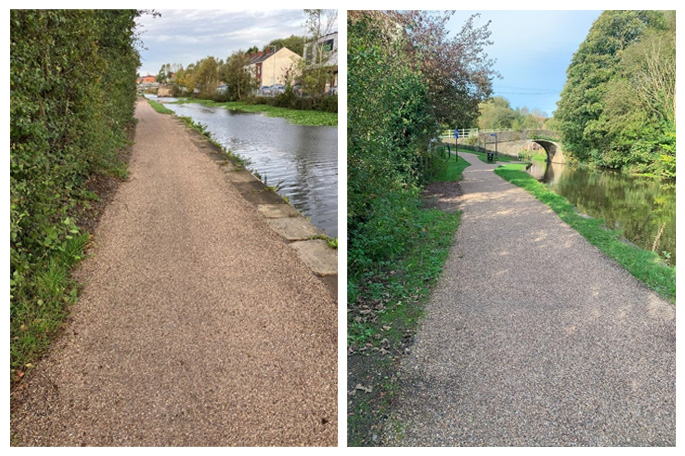 Leeds and Liverpool canal towpath - after images
Header
Text here
Add image
Header
Text here
Add image
Header
Text here
Add image
Header
Text here
Add image
Header
Text here
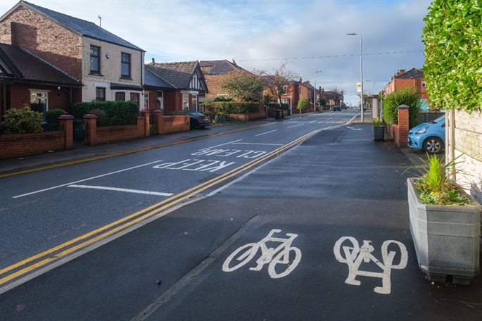
Work on site to construct phase one of the Wigan to Standish Walking and Cycling Network is now complete.
The scheme has provided safe crossing facilities to Wigan Town Centre with access to all the services located there, including bus and train stations, shops, and health and leisure facilities. The scheme has now given local residents the option to walk, wheel or cycle safely into town rather than driving.
This is a densely populated area of Wigan, with little or no provision for crossing busy roads, and access to the town centre from this area is difficult if you are walking, wheeling or cycling.
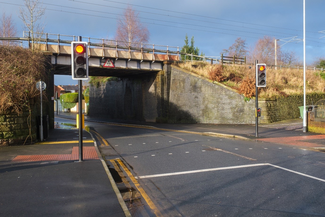
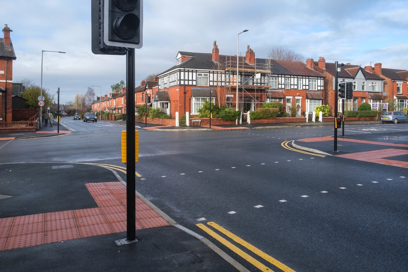
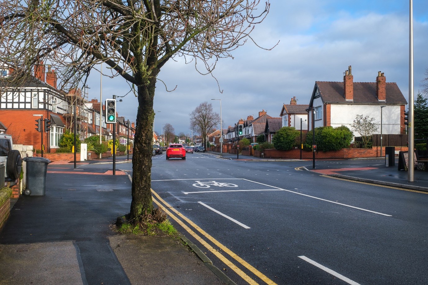
Wigan Council was awarded external funding from The Mayor’s Challenge Fund to improve the following three junctions, which comprised the following:
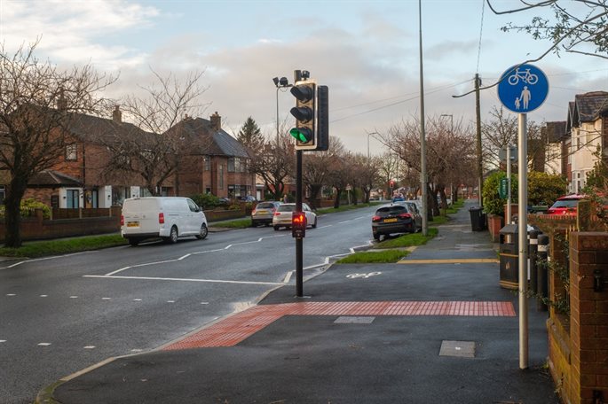
- Kenyon Road
- Existing traffic signals upgraded to include full pedestrian crossing facilities
- Widened footways around the junction to provide more space for pedestrians
- Bus stop repositioned away from the junction (towards Wigan Town Centre on Kenyon Road).
- Spencer Road West
- New Toucan crossing across Spencer Road West (between passageways from Dawson Avenue and Barnsley St).
- Buckley Street
- New ‘SHUTTLE’ traffic signals under Buckley St railway bridge
- Widening of footways for shared pedestrian / cycleway under bridge (linking passageway from Back Buckley Street / Gillan Road and the path to Mesnes park)
- Toucan crossing on Walkden Avenue, connecting Mesnes Park path with shared use facility.
Header
Text here
Header
Text here
Header
Text here
Header
Text here
Header
Text here
Add image
Header
Text here
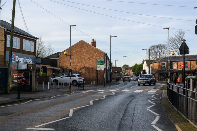
This scheme upgraded the former zebra crossing on Market Street to a puffin crossing to enable safer crossing for pedestrians visiting Standish Town Centre.
The crossing works were completed during October-December 2023, and further carriageway resurfacing improvements completed in January 2024 with the new crossing signals synced to the existing signals at the High Street junction to assist with traffic flow.
Header
Text here
Header
Text here
Add image
Header
Text here
Add image
Header
Text here
Add image
Header
Text here
Add image
Header
Text here
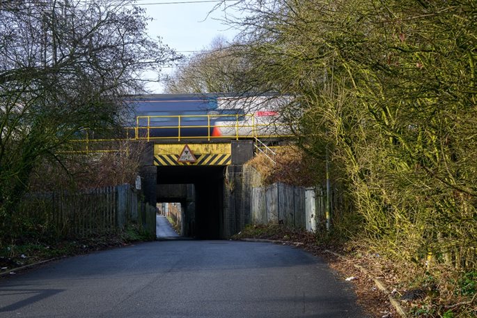
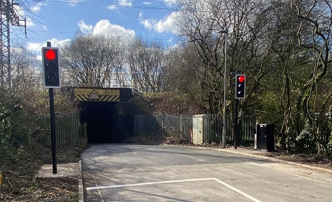
The aim of this scheme was to improve road safety by removing the existing conflict with two-way traffic under the West Coast Mainline on Bradley Lane, bridge, enabling pedestrians to walk under the bridge safely under traffic signal control.
Residents were consulted on the scheme in 2023, and the resident feedback from the proposals fed into the design work, with the scheme constructed during February half term in 2024.
Photographs of the scheme are below, including:
- A new 20mph speed limit on both approaches to the bridge.
- Both sets of traffic lights rest on red until vehicles are near, this ensures that motorists do not build up speed as they approach the bridge.
- Warning signs have been installed at either side of the bridge to warn drivers that there may be pedestrians in the carriageway, and larger, sensor activated signs will complete the scheme
- View You Said, We Listened in relation to the scheme proposals.
Header
Text here
Header
Text here
Add image
Header
Text here
Add image
Header
Text here
Add image
Header
Text here
Add image
Header
Text here
Civic Centre Public Realm
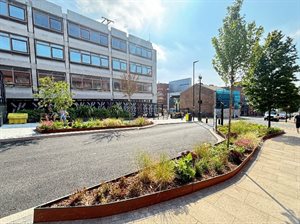 Wigan Council have improved the safety and appearance of the current road layout outside the Civic Centre building on Millgate.
The public realm scheme prioritises pedestrians and creates an attractive environment which supports a diverse range of users, providing better and safer access to activities in the town.
The visual impact of the area has been greatly enhanced with the works and associated street furniture.
Funded by the Future High Streets Fund, the scheme enhances the development works of the Civic Centre building and makes connections to Believe Square. We are committed to delivering more pedestrianised spaces to encourage active and safe travel for all and enhance the area with greenery.
Works include:
- Relocation of automated bollard from Millgate (adjacent to Hedera) to the junction of Hewlett Street
- Extension of the one-way (south-eastbound) operation on Millgate to Hewlett Street
- Removal of pay and display bay from northeast side of Millgate.
- Introduction of crossing points outside Civic building aligning with Believe Square
- Installation of street furniture and planting
- Resurfacing.
Works started on site early December 2023 and were substantially completed in April. Over the past few months installation of street furniture and planning have been completed.
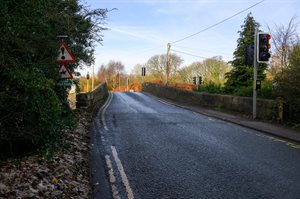
The Major Projects Team have developed a scheme to upgrade the existing traffic signals across all arms of the canal bridge structure on Red Rock Lane with the latest technology. The smarter signals, that have been installed, are equipped with sensors to monitor the sequence and flow of traffic. By working more efficiently, the new signals will reduce delays on the borough’s road network.
You asked, We answered
View our frequently asked questions in relation to the scheme.